The largest settlement within the Derbyshire Dales is Matlock. It is one of a string of smaller settlements, the 'Matlocks', now identified as 5 separate conservation areas. Matlock Bridge refers to the area situated around the Crown Square and the 13th century bridge (which was widened in the early years of the 20th century).
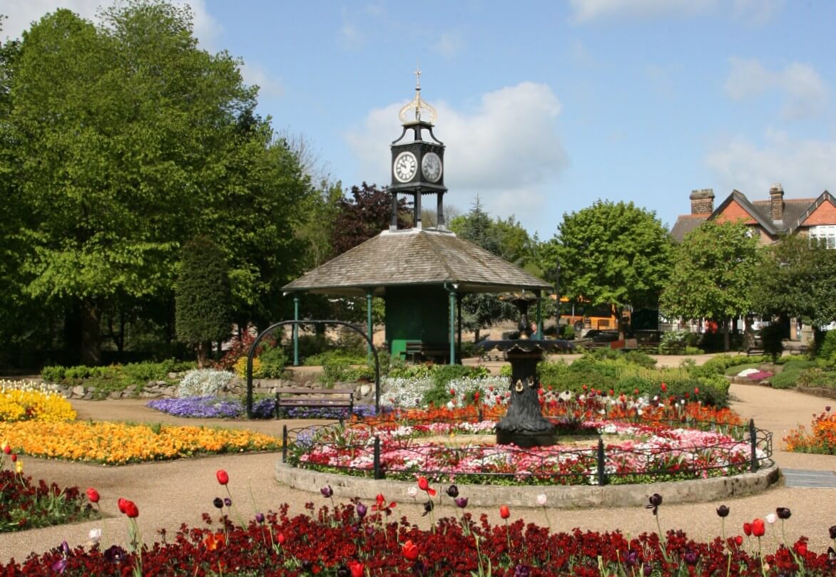
This area primarily developed in a relatively short period at the end of the 19th century, when the railway station enabled visitors to enjoy the benefits of the hydrotherapy establishments, particularly Smedley's Hydro, in Matlock Bank. A cable tram, which had a terminus in Crown Square, would transport visitors up the steep Bank. The tram system created a focus and encouraged economic development and facilities and establishments, such as numerous commercial properties along Dale Road, and hotels and inns such as the Olde Englishe on Dale Road, The Crown Hotel and the Railway Inn on Bakewell Road furthered economic stimulation. In terms of buildings, most are constructed in stone, and the variety of building styles reflect the late 19th century eclecticism in architecture, with examples of Gothic Revival, Italianate and Baroque Revival. This period also led to the development of Hall Leys Park, with its Broad Walk on which to promenade alongside the river Derwent and the result was, and still is, an attractive green public open space within the heart of the town.
Matlock Bridge Conservation Area is a predominantly urban area, the boundary of which originally encompassed Dale Road, Matlock Station and Bridge. The Conservation Area boundary was designated in October 1989, but it was further extended in July 2008. The boundary now includes Crown Square and properties along Bakewell Road and Bank Road to the north. Hall Leys Park is now included to the east and the River Derwent forms the boundary to the south. The railway bridge, line and Holt Lane are included to the west and some properties at the southern end of Snitterton Road. The Conservation Area also includes Matlock Station and associated buildings. The Conservation Area currently comprises 13.5 hectares.
Historic Assets
Within Matlock Bridge Conservation Area there are 283 buildings, of which 3 are listed entries. The listed buildings in Matlock Bridge are Derwent Bridge, which is both a listed structure (Grade II*) and a Scheduled monument, the Station Masters House (Grade II) and the Royal Bank of Scotland (Grade II). They all contribute, both individually and visually, within the street-scene.
Matlock Bridge Conservation Area Character Appraisal
In 2003 a comprehensive Conservation Area Character Appraisal was approved, which accessed the special qualities of the character and appearance of Matlock Bridge Conservation Area, both in terms of its buildings and the relationship of its spaces, alongside those buildings. It assessed the archaeology; origins and development of the area; the architectural and historic quality; the setting and landscape of the area; an analysis of the character and considered the negative and neutral factors which impact on the Conservation Area. Coupled with this, the document made reference to planning policies and strategies that work to enhance and preserve the special character and appearance of the area. This document also formed part of a wider initiative, which was used to secure grant funding, targeted at commercial properties. This was for repairs and replacement of architectural details in the area and to stimulate economic investment. This Heritage Economic Regeneration Scheme was in operation for four years until the match funding from English Heritage was no longer available. In that period many of the commercial buildings (and some residential properties) in the area had significant grant aid injected in order to repair or restore their physical fabric - shop fronts, roofs, stone-work repairs, windows etc.
Following this, consideration was given to extending the Matlock Bridge Conservation Area and a further Appraisal was carried out. This Appraisal also assessed the character and appearance of buildings and areas outside the existing conservation area and in July 2008, a new boundary was approved for Matlock Bridge Conservation Area.
Buildings at Risk
None of the listed buildings within the Matlock Bath Conservation Area are recognised by the District Council as being 'at risk'.
Article 4 Directions
Where an Article 4 Direction is in place in the District they remove specified 'permitted development 'rights from a property, which means that planning permission will be required for the works as specified in the Direction. In October 2006 an Article 4 Direction was established in Matlock Bridge Conservation Area for number of buildings both commercial and residential, along Dale Road, Holt Lane, Snitterton Road and Derwent Avenue.
In November 2012 a review of the Article 4 Direction was undertaken. As a result of this it was evident that alterations made to those properties with controls in place since 2006 have virtually all resulted in a positive improvement to those premises. Therefore it was considered that the Matlock Bridge Article 4 Direction has been beneficial to the area and it was recommended that the current Matlock Bridge Article 4 Direction remains in force without modification. The District Council approved this on 29th November 2012 and the Report for this can be found in the Related Documents below.
For further details as to the individual properties covered by the Direction and the restrictions on those properties, please refer to Related Documents below.
Related Documents
Matlock Bridge Conservation Area Map (PDF 332KB)
Matlock Bridge Conservation Area Appraisal 2003 (PDF 4058KB)
Matlock Bridge Conservation Area Appraisal 00 Contents (PDF 207KB)
Matlock Bridge Conservation Area Appraisal 01 Introduction (PDF 2316KB)
Matlock Bridge Conservation Area Appraisal 02 Archaeology (PDF 34KB)
Matlock Bridge Conservation Area Appraisal 03 Origins and Development (PDF 632KB)
Matlock Bridge Conservation Area Appraisal 04 Architectural and Historic Quality (PDF 779KB)
Matlock Bridge Conservation Area Appraisal 05 Setting of the Conservation Area (PDF 1424KB)
Matlock Bridge Conservation Area Appraisal 06 Landscape and Streetscape Appraisal (PDF 661KB)
Matlock Bridge Conservation Area Appraisal 07 Spatial Relationships and Character (PDF 1435KB)
Matlock Bridge Conservation Area Appraisal 08 Negative Factors (PDF 1894KB)
Matlock Bridge Conservation Area Appraisal 09 Neutral Factors (PDF 37KB)
Matlock Bridge Conservation Area Appraisal 10 Rationale for CA Extension (PDF 1612KB)
Matlock Bridge Conservation Area Appraisal Committee Report and minutes (PDF 151KB)
Matlock Bridge Article 4 Statement (PDF 144KB)
Matlock Bridge Article 4 Direction Map (PDF 1416KB)
Matlock Bridge Article 4 Direction Schedule (PDF 48KB)
Matlock Bridge Article 4 Review 2012 (PDF 15KB)